
About your Choice for Specialist Surveys and Reality Capture
Our Mission
At Norelo, we are committed to collaborating with clients to understand and address their unique requirements and expectations. By leveraging the latest technology to deliver accurate and actionable data, we inspire innovation and ensure that safety and quality always come first.
Our Vision
Through dilligent data capture we will provide precise, comprehensive insights to build a smarter, more resilient future.
KSNPM have been using Norelo for years for a wide range of data collection services to accompany our surveying and project management business. The photogrammetry and point cloud surveys are second to none which is why we continue to use them time and time again. Norelo cater to reactive project times and have a quick turn around on delivering the results. The team are incredibly professional and friendly, we highly recommend their services, and they offer top-tier CPD sessions for your workplace. 5 stars!
KSN Project Management
EXECUTIVE TEAM

We used Norelo for drone surveys as part of a large group of building surveys. The inspection period was very short and Norelo had no issues in meeting this challenging deadline. Magnus is readily contactable and easy to work with. The output quality is also very good.
James Taylor
ASSOCIATE DIRECTOR
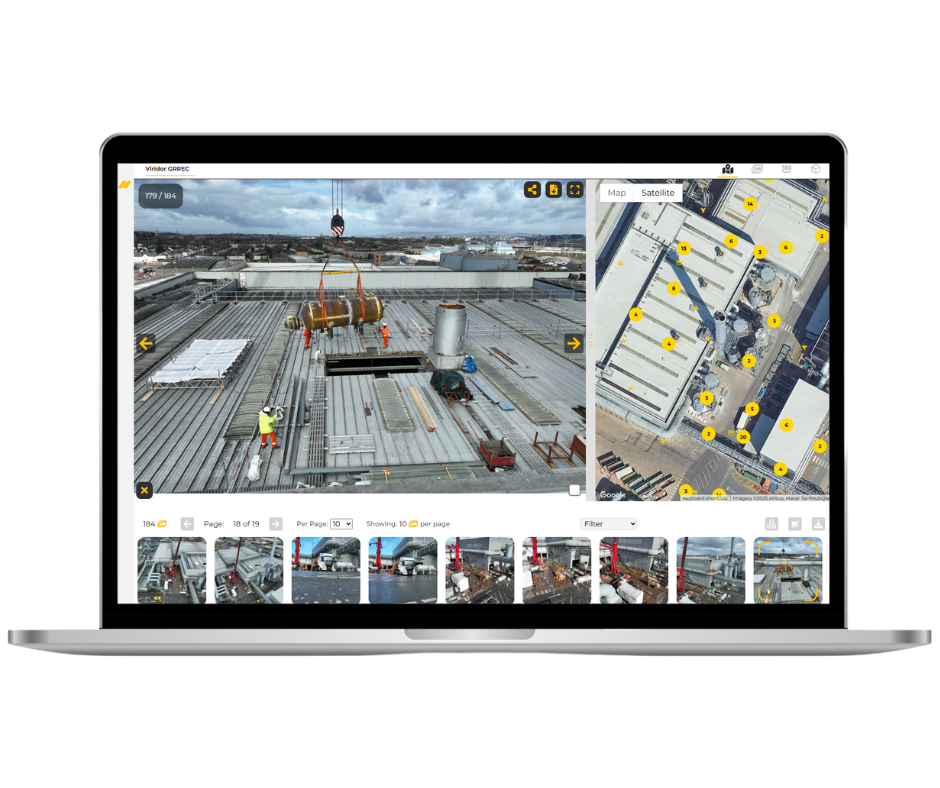
Carried out a survey on the roof of our industrial site. Very reliable contractor, communicative and professional. Very happy with the end result and the usability of the asset inspection software.
Michael Carr
OPERATIONS MANAGER
Trusted By
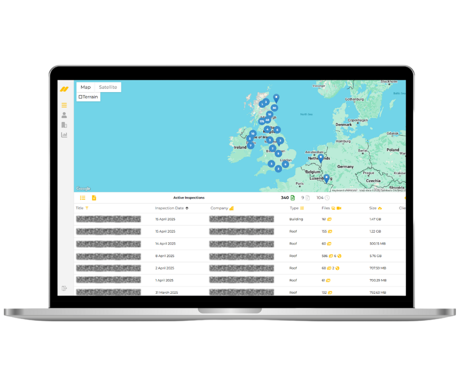
Norelo Ltd, is dedicated to delivering cutting-edge surveying solutions across the United Kingdom. Norelo’s team of seasoned professionals combines technical expertise with innovative technology to provide accurate, high-quality data, tailored to your project requirements.
